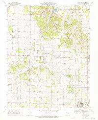
1969 Map of Chesapeake
USGS Topo · Published 1971About this map
The Chesapeake Spring and an adjacent Fish Hatchery define the northern portion of this Lawrence County landscape as it appeared in the late 1960s. This region is characterized by the broad stretches of Turnback and Buck Prairie, where agricultural life is anchored by small communities like Chesapeake, McKinley, and Orange. In the south, the city of Marionville serves as a local hub, situated along the St Louis - San Francisco railroad line. Local heritage is preserved in the numerous country churches and burial grounds dotting the terrain, including Dover Ch, McNatt Chapel, and the Campground Cem. The mapping of local watercourses such as Goose Creek and Honey Creek illustrates the drainage patterns that shaped the settlement of these Missouri prairies.
Find a feature on this map
30 named features on this map. Tap any name to fly to it.
Don’t see what you’re looking for? This feature index may not catch every label — zoom into the map to look around manually.
Map Details
Editions of this 1969 Chesapeake Map
2 editions found
Other maps of this area

1886 · Greenfield
USGS Topo · 1:125,000

1888 · Greenfield
USGS Topo · 1:125,000

1919 · Halltown
USGS Topo · 1:62,500

1921 · Stotts City
USGS Topo · 1:62,500

1942 · Aurora
USGS Topo · 1:62,500

1943 · Monett
USGS Topo · 1:62,500

1945 · Harrison
USGS Topo · 1:250,000

1945 · Aurora
USGS Topo · 1:62,500

1949 · Harrison
USGS Topo · 1:250,000

1954 · Harrison
USGS Topo · 1:250,000