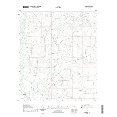
2020 Map of Chesbrough
USGS Topo · Published 2020About this map
The Tangipahoa River carves through the western edge of this parish landscape, anchoring a region defined by scattered rural settlements and a significant concentration of family burial grounds. Central to the area is Chesbrough, situated at a crossroads north of Roseland and Amite City. The map reveals a dense genealogical record through its many preserved cemeteries, such as the Old Bankston Cem and New Bankston Cem, alongside community landmarks like the Good Hope Church Cem. To the northeast, the settlement of Bolivar sits near the headwaters of Dyson Br. The terrain is finely dissected by numerous small waterways, including Big Creek and Bunch Br, which influence the winding paths of local roads like Vernon Town Rd and Perry Town Rd. This 2020 survey documents the enduring rural character and residential clusters like Providence Ests within the piney woods environment of northern Louisiana.
Find a feature on this map
111 named features on this map. Tap any name to fly to it.
Don’t see what you’re looking for? This feature index may not catch every label — zoom into the map to look around manually.
Map Details
Editions of this 2020 Chesbrough Map
This is the sole edition of this map. No revisions or reprints were ever made.
Other maps of this area

1939 · Sunny Hill
USGS Topo · 1:31,680

1940 · Spring Creek
USGS Topo · 1:31,680

1940 · Roseland
USGS Topo · 1:31,680

1942 · Roseland
USGS Topo · 1:31,680

1942 · Husser
USGS Topo · 1:31,680

1942 · Wilmer
USGS Topo · 1:31,680

1942 · Loranger
USGS Topo · 1:31,680

1949 · Bolivar
USGS Topo · 1:31,680

1949 · Amite
USGS Topo · 1:31,680

1950 · Kentwood
USGS Topo · 1:31,680