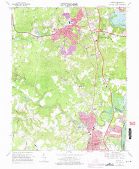
1969 Map of Chester
USGS Topo · Published 1975About this map
Chester serves as the focal point of this Virginia survey, positioned where the Seaboard Coast Line railroad and local roads like Stage Road and Church Road intersect. The landscape is a mix of expanding residential developments like Sherwood Hills and Ashton alongside legacy institutions such as St Johns Ch and Zion Ch. To the east, the James River snakes past Dutch Gap and Farrar Island, showing the Old Channel and extensive Tidal Flats. This era of the late 1960s and early 1970s reveals a suburbanizing Chesterfield County, evidenced by the presence of John Tyler College and the growing boundary of Colonial Heights near the Appomattox River. The map meticulously details the transit infrastructure, including the Richmond-Petersburg Turnpike and numerous creek crossings over Swift Creek and its many branches.
Find a feature on this map
89 named features on this map. Tap any name to fly to it.
Don’t see what you’re looking for? This feature index may not catch every label — zoom into the map to look around manually.
Map Details
Editions of this 1969 Chester Map
4 editions found
Other maps of this area

1894 · Bermuda Hundred
USGS Topo · 1:62,500

1894 · Petersburg
USGS Topo · 1:62,500

1897 · Amelia
USGS Topo · 1:125,000

1938 · Dutch Gap
USGS Topo · 1:24,000

1938 · Drewrys Bluff
USGS Topo · 1:24,000

1943 · Dutch Gap
USGS Topo · 1:31,680

1943 · Chesterfield
USGS Topo · 1:31,680

1943 · Hopewell
USGS Topo · 1:31,680

1943 · Beach
USGS Topo · 1:24,000

1943 · Sutherland
USGS Topo · 1:24,000