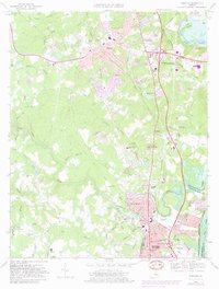
1969 Map of Chester
USGS Topo · Published 1981About this map
Chester sits at the heart of this landscape, positioned along the busy corridor between Richmond and Petersburg. The map captures the suburban transformation of Chesterfield County, where established communities like Ashton, Walthall, and Woodlawn are increasingly connected by the Richmond-Petersburg Turnpike. Significant institutional markers include the campus of John Tyler College and several historic houses of worship such as St Johns Ch and Bethesda Ch. To the east, the James River snakes through Aiken Swamp and around Farrar Island, reflecting the area's deep ties to river navigation and industrial resource extraction, evidenced by various Sand and Gravel Pits. Preservation efforts are visible at Richmond National Battlefield Park, providing a historical counterpoint to the rapid expansion of Colonial Heights and the infrastructure supporting the Seaboard Coast Line railroad.
Find a feature on this map
98 named features on this map. Tap any name to fly to it.
Don’t see what you’re looking for? This feature index may not catch every label — zoom into the map to look around manually.
Map Details
Editions of this 1969 Chester Map
4 editions found
Other maps of this area

1894 · Bermuda Hundred
USGS Topo · 1:62,500

1894 · Petersburg
USGS Topo · 1:62,500

1897 · Amelia
USGS Topo · 1:125,000

1938 · Dutch Gap
USGS Topo · 1:24,000

1938 · Drewrys Bluff
USGS Topo · 1:24,000

1943 · Dutch Gap
USGS Topo · 1:31,680

1943 · Chesterfield
USGS Topo · 1:31,680

1943 · Hopewell
USGS Topo · 1:31,680

1943 · Beach
USGS Topo · 1:24,000

1943 · Sutherland
USGS Topo · 1:24,000