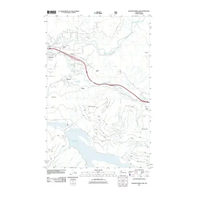
2011 Map of Chester Morse Lake
USGS Topo · Published 2011About this map
Chester Morse Lake dominates the southern portion of this landscape, its waters held back by the Crib Dam and fed by numerous tributaries including McClellan Creek and Rack Creek. In the north, the valley of the Middle Fork Snoqualmie River hosts established communities such as Riverbend, Tanner, and Sallal Prairie. This 2011 survey records a network of mountain roads and legacy infrastructure within the Snoqualmie corridor, including the North Bend Airstrip and the educational facility at Camp Waskowitz.
Find a feature on this map
72 named features on this map. Tap any name to fly to it.
Don’t see what you’re looking for? This feature index may not catch every label — zoom into the map to look around manually.
Map Details
Editions of this 2011 Chester Morse Lake Map
This is the sole edition of this map. No revisions or reprints were ever made.
Other maps of this area

1913 · Cedar Lake
USGS Topo · 1:125,000

1921 · Sultan
USGS Topo · 1:125,000

1923 · Sultan
USGS Topo · 1:125,000

1953 · Snoqualmie
USGS Topo · 1:24,000

1953 · North Bend
USGS Topo · 1:24,000

1953 · Eagle Gorge
USGS Topo · 1:24,000

1957 · Wenatchee
USGS Topo · 1:250,000

1960 · Mount Si
USGS Topo · 1:62,500

1960 · Bandera
USGS Topo · 1:62,500

1975 · Snoqualmie Pass
USGS Topo · 1:100,000