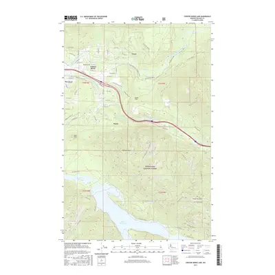
2017 Map of Chester Morse Lake
USGS Topo · Published 2017About this map
The Middle Fork Snoqualmie River and South Fork Snoqualmie River dominate this 2017 landscape, where the Cascades meet the developing outskirts of King County. Modern infrastructure like Interstate 90 and the Snoqualmie Valley Trl cuts through the terrain, connecting the residential areas of North Bend and Riverbend to the vast wilderness of the Snoqualmie National Forest. The map provides a detailed view of the water management infrastructure in the southern half, centered on the Masonry Pool and the extensive Chester Morse Lake reservoir, which is fed by numerous named creeks including Dumbarton Cr, Otter Cr, and Rack Cr.
Find a feature on this map
71 named features on this map. Tap any name to fly to it.
Don’t see what you’re looking for? This feature index may not catch every label — zoom into the map to look around manually.
Map Details
Editions of this 2017 Chester Morse Lake Map
This is the sole edition of this map. No revisions or reprints were ever made.
Other maps of this area

1913 · Cedar Lake
USGS Topo · 1:125,000

1921 · Sultan
USGS Topo · 1:125,000

1923 · Sultan
USGS Topo · 1:125,000

1953 · Snoqualmie
USGS Topo · 1:24,000

1953 · North Bend
USGS Topo · 1:24,000

1953 · Eagle Gorge
USGS Topo · 1:24,000

1957 · Wenatchee
USGS Topo · 1:250,000

1960 · Mount Si
USGS Topo · 1:62,500

1960 · Bandera
USGS Topo · 1:62,500

1975 · Snoqualmie Pass
USGS Topo · 1:100,000