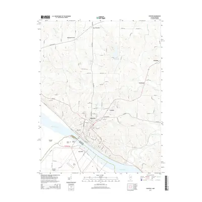
2015 Map of Chester
USGS Topo · Published 2015About this map
The Mississippi River serves as the dominant geographic and jurisdictional boundary on this survey, separating Randolph County, Illinois from Perry County, Missouri. The city of Chester sits perched on the eastern bluffs, a regional hub defined by its transit connections and institutional presence, including the neighboring community of Menard. The Chester Bridge provides a vital link across the river to Horse Island and the bottomlands of Claryville. Away from the river, the landscape is dotted with smaller settlements like New Palestine and Diamond Cross, which remain connected by historic routes such as the Shawneetown Trl.
Find a feature on this map
106 named features on this map. Tap any name to fly to it.
Don’t see what you’re looking for? This feature index may not catch every label — zoom into the map to look around manually.
Map Details
Editions of this 2015 Chester Map
This is the sole edition of this map. No revisions or reprints were ever made.
Other maps of this area

1912 · Baldwin
USGS Topo · 1:62,500

1914 · Baldwin
USGS Topo · 1:62,500

1914 · Coulterville
USGS Topo · 1:62,500

1915 · Chester
USGS Topo · 1:62,500

1916 · Campbell Hill
USGS Topo · 1:62,500

1917 · Coulterville
USGS Topo · 1:62,500

1918 · Campbell Hill
USGS Topo · 1:62,500

1942 · Baldwin
USGS Topo · 1:62,500

1947 · Chester
USGS Topo · 1:62,500

1949 · Paducah
USGS Topo · 1:250,000