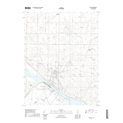
2018 Map of Chester
USGS Topo · Published 2018About this map
The city of Chester sits on the bluffs overlooking the Mississippi River, serving as a critical point of connection between Illinois and Missouri. The landscape here is defined by the shifting course of the river, which has created unique geographic features such as Kaskaskia Island and Horse Island. This survey illustrates the complex boundary lines and land divisions, including Bols Brule, that have shaped local property history. Significant historical landmarks are documented, notably the Little Marys River Covered Bridge spanning the Little Marys River. Rural life is etched into the terrain through various family and community burial grounds, such as Saint Marys Cem and Evergreen Cem. North of the city, the small settlement of New Palestine and the Randolph County Lake provide a view of the more upland, agricultural character of the county.
Find a feature on this map
107 named features on this map. Tap any name to fly to it.
Don’t see what you’re looking for? This feature index may not catch every label — zoom into the map to look around manually.
Map Details
Editions of this 2018 Chester Map
This is the sole edition of this map. No revisions or reprints were ever made.
Other maps of this area

1912 · Baldwin
USGS Topo · 1:62,500

1914 · Baldwin
USGS Topo · 1:62,500

1914 · Coulterville
USGS Topo · 1:62,500

1915 · Chester
USGS Topo · 1:62,500

1916 · Campbell Hill
USGS Topo · 1:62,500

1917 · Coulterville
USGS Topo · 1:62,500

1918 · Campbell Hill
USGS Topo · 1:62,500

1942 · Baldwin
USGS Topo · 1:62,500

1947 · Chester
USGS Topo · 1:62,500

1949 · Paducah
USGS Topo · 1:250,000