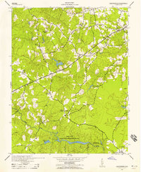
1943 Map of Chesterfield
USGS Topo · Published 1958About this map
Swift Creek and its southern tributaries dominate this mid-century landscape in the vicinity of Chesterfield. This 1943 survey, published by the U.S. Geological Survey for the War Department, reveals a rural community defined by its water resources and civic institutions. The large Swift Creek Recreational Demonstration Area anchors the southern half of the map, featuring the Shawondasee Boy Scout Camp and the impounded waters of Third Branch Lake.
Find a feature on this map
25 named features on this map. Tap any name to fly to it.
Don’t see what you’re looking for? This feature index may not catch every label — zoom into the map to look around manually.
Map Details
Editions of this 1943 Chesterfield Map
3 editions found

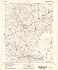
Other maps of this area

1890 · Goochland
USGS Topo · 1:125,000

1892 · Goochland
USGS Topo · 1:125,000

1894 · Bermuda Hundred
USGS Topo · 1:62,500

1894 · Richmond
USGS Topo · 1:62,500

1895 · Richmond
USGS Topo · 1:62,500

1897 · Amelia
USGS Topo · 1:125,000

1934 · Richmond
USGS Topo · 1:24,000

1936 · Richmond West
USGS Topo · 1:24,000

1938 · Drewrys Bluff
USGS Topo · 1:24,000

1939 · Richmond
USGS Topo · 1:31,680