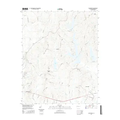
2016 Map of Chesterfield
USGS Topo · Published 2016About this map
The community of Chesterfield and the eastern edge of Lexington anchor this landscape in Henderson County, characterized by a dense network of country roads and local cemeteries that speak to generations of family settlement. Named burial grounds like Halbrook Cem, Lindsey Cem, and Autrey Cem are scattered across the terrain, often located near small watercourses such as Harmon Cr and Haley Cr. The area is notably defined by its water management and recreation sites, including Cedar Lake, Pinoak Lake, and Redbud Lake, which dot the central and eastern portions of the map. Smaller crossroads like Alberton and Pleasant Hill remain central to the local geography, connected by routes like Alberton Rd and Mazies Chapel Rd. This survey reflects a modern view of rural West Tennessee, where agricultural history persists alongside newer residential developments and protected water resources.
Find a feature on this map
93 named features on this map. Tap any name to fly to it.
Don’t see what you’re looking for? This feature index may not catch every label — zoom into the map to look around manually.
Map Details
Editions of this 2016 Chesterfield Map
This is the sole edition of this map. No revisions or reprints were ever made.
Other maps of this area

1936 · Clarksburg
USGS Topo · 1:24,000

1936 · Lexington
USGS Topo · 1:24,000

1936 · Yuma
USGS Topo · 1:24,000

1936 · Scotts Hill
USGS Topo · 1:24,000

1936 · Parsons
USGS Topo · 1:24,000

1936 · Reagan
USGS Topo · 1:24,000

1936 · Cavvia
USGS Topo · 1:24,000

1936 · Life
USGS Topo · 1:24,000

1936 · Chesterfield
USGS Topo · 1:24,000

1950 · Reagan
USGS Topo · 1:24,000