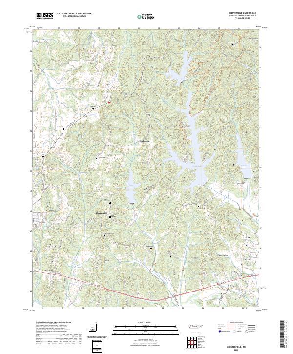
2022 Map of Chesterfield
USGS Topo · Published 2022About this map
Pinoak Lake and the smaller Redbud Lake and Cedar Lake dominate this Henderson County landscape, where the terrain is carved by numerous creek branches like Haley Creek and Harmon Creek. This modern survey reveals a community anchored by small settlements such as Chesterfield, Alberton, and Pleasant Hill, with the eastern edge of Lexington appearing in the southwest. For family historians, the area is notably dense with small burial grounds, including the Mazies Chapel Cem, Central Grove Cem, and Autrey Cem. The road network highlights the modern corridor of highway 412, which runs east-west above the Beech River, while the Natchez Trace Rd preserves the name of the ancient wilderness trail that once defined movement through this part of Tennessee.
Find a feature on this map
109 named features on this map. Tap any name to fly to it.
Don’t see what you’re looking for? This feature index may not catch every label — zoom into the map to look around manually.
Map Details
Editions of this 2022 Chesterfield Map
This is the sole edition of this map. No revisions or reprints were ever made.
Other maps of this area

1936 · Clarksburg
USGS Topo · 1:24,000

1936 · Lexington
USGS Topo · 1:24,000

1936 · Yuma
USGS Topo · 1:24,000

1936 · Scotts Hill
USGS Topo · 1:24,000

1936 · Parsons
USGS Topo · 1:24,000

1936 · Reagan
USGS Topo · 1:24,000

1936 · Cavvia
USGS Topo · 1:24,000

1936 · Life
USGS Topo · 1:24,000

1936 · Chesterfield
USGS Topo · 1:24,000

1950 · Reagan
USGS Topo · 1:24,000