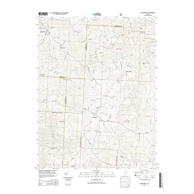
2013 Map of Chesterhill
USGS Topo · Published 2013About this map
Chesterhill and Bartlett anchor this map at the borders of Morgan, Athens, and Washington Counties, showing a rural landscape defined by narrow ridgeline roads and deeply incised stream valleys. This part of Ohio is characterized by its Quaker heritage, evident in landmarks like the Old Quaker Cem and Bartlett Friends Cem. The terrain is carved by numerous waterways including the W Br Wolf Cr, Coal-Run, and the W Br Little Hocking River, which flow through the timbered sections of the Wayne National Forest. Small, historically significant locales such as Plantsville, Patten Mills, and Dale are connected by a network of state and local routes like Oh-555 and Oh-550. Numerous family and community burial grounds, including Bethel Cem and Fairview Church Cem, are scattered across the township lines, providing valuable markers for genealogical research in this Appalachian plateau region.
Find a feature on this map
98 named features on this map. Tap any name to fly to it.
Don’t see what you’re looking for? This feature index may not catch every label — zoom into the map to look around manually.
Map Details
Editions of this 2013 Chesterhill Map
This is the sole edition of this map. No revisions or reprints were ever made.
Other maps of this area

1902 · Parkersburg
USGS Topo · 1:62,500

1904 · Parkersburg
USGS Topo · 1:62,500

1904 · Chesterhill
USGS Topo · 1:62,500

1906 · Chesterhill
USGS Topo · 1:62,500

1909 · Caldwell
USGS Topo · 1:62,500

1910 · Mc Connelsville
USGS Topo · 1:62,500

1912 · Caldwell
USGS Topo · 1:62,500

1949 · Clarksburg
USGS Topo · 1:250,000

1956 · Clarksburg
USGS Topo · 1:250,000

1960 · Watertown
USGS Topo · 1:24,000