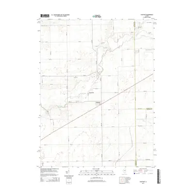
2015 Map of Chestnut
USGS Topo · Published 2015About this map
The settlement of Chestnut serves as the primary hub in this portion of Logan County, situated within a landscape defined by an orderly grid of rural roads and the winding path of Salt Creek. This 2015 survey reveals a terrain deeply connected to its agricultural roots, where the small community of Bakerville sits just north of the creek's meandering channel. For those exploring the area's local heritage, the map is a valuable resource for identifying several family and community burial grounds, including Donnan Cem and Laenna Cem near the central townships, and Harmony Cem in the northwestern corner. The southern reach of the quadrangle introduces the N Fork Lake Fork, while small landmarks like Pine Lake punctuate the open country. The intersection of three counties—Logan, De Witt, and Macon—is documented here, reflecting the long-established boundaries that have shaped the region's administration and land ownership.
Find a feature on this map
38 named features on this map. Tap any name to fly to it.
Don’t see what you’re looking for? This feature index may not catch every label — zoom into the map to look around manually.
Map Details
Editions of this 2015 Chestnut Map
This is the sole edition of this map. No revisions or reprints were ever made.
Other maps of this area

1911 · Lincoln
USGS Topo · 1:62,500

1913 · Lincoln
USGS Topo · 1:62,500

1954 · Niantic
USGS Topo · 1:62,500

1954 · Mechanicsburg
USGS Topo · 1:62,500

1957 · Kenney
USGS Topo · 1:62,500

1958 · Peoria
USGS Topo · 1:250,000

1958 · Decatur
USGS Topo · 1:250,000

1961 · Peoria
USGS Topo · 1:250,000

1961 · Decatur
USGS Topo · 1:250,000

1963 · Peoria
USGS Topo · 1:250,000