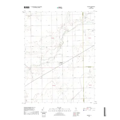
2018 Map of Chestnut
USGS Topo · Published 2018About this map
Chestnut sits at the heart of this central Illinois landscape, where the agricultural grid meets the winding course of Salt Creek. The map documents a rural transition zone where the borders of Logan, De Witt, and Macon counties converge. Local history and genealogy are anchored by numerous burial grounds scattered across the townships, including Harmony Cem to the northwest and Pleasant Valley Cem near the eastern boundary. The drainage patterns of N Fork Lake Fork and Pine Lake disrupt the geometric road system, showing the persistent influence of the natural hydrology on local land use. Researchers can trace the secondary road network, such as Old Settlers Rd and W Washington Street Rd, which connect these dispersed settlements and family farmsteads.
Find a feature on this map
45 named features on this map. Tap any name to fly to it.
Don’t see what you’re looking for? This feature index may not catch every label — zoom into the map to look around manually.
Map Details
Editions of this 2018 Chestnut Map
This is the sole edition of this map. No revisions or reprints were ever made.
Other maps of this area

1911 · Lincoln
USGS Topo · 1:62,500

1913 · Lincoln
USGS Topo · 1:62,500

1954 · Niantic
USGS Topo · 1:62,500

1954 · Mechanicsburg
USGS Topo · 1:62,500

1957 · Kenney
USGS Topo · 1:62,500

1958 · Peoria
USGS Topo · 1:250,000

1958 · Decatur
USGS Topo · 1:250,000

1961 · Peoria
USGS Topo · 1:250,000

1961 · Decatur
USGS Topo · 1:250,000

1963 · Peoria
USGS Topo · 1:250,000