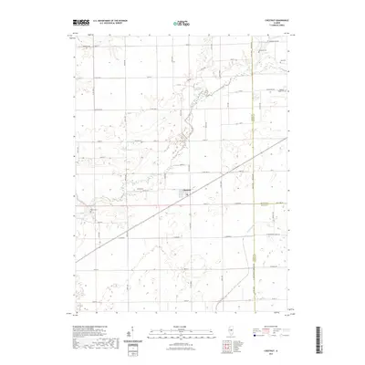
2021 Map of Chestnut
USGS Topo · Published 2021About this map
The unincorporated community of Chestnut serves as the central hub of this agricultural landscape in Logan County, situated at the junction of several county roads and a rail line. The terrain is defined by the winding course of Salt Creek as it meanders through the western half of the quadrangle, creating a distinct riparian belt amidst the surrounding section-line farmlands. Cultural history is anchored by a significant number of family and community burial grounds, including Harmony Cem, Donnan Cem, and Laenna Cem, which are scattered throughout the countryside, often near historic road intersections. These small, rural cemeteries provide a direct link to the 19th-century settlement patterns of central Illinois, where small churchyards and family plots were established within walking distance of homesteads. To the south, the N Fork Lake Fork and the small body of water at Pine Lake mark the lower reaches of the drainage system, while the eastern boundary traces the border between Logan and De Witt counties.
Find a feature on this map
61 named features on this map. Tap any name to fly to it.
Don’t see what you’re looking for? This feature index may not catch every label — zoom into the map to look around manually.
Map Details
Editions of this 2021 Chestnut Map
This is the sole edition of this map. No revisions or reprints were ever made.
Other maps of this area

1911 · Lincoln
USGS Topo · 1:62,500

1913 · Lincoln
USGS Topo · 1:62,500

1954 · Niantic
USGS Topo · 1:62,500

1954 · Mechanicsburg
USGS Topo · 1:62,500

1957 · Kenney
USGS Topo · 1:62,500

1958 · Peoria
USGS Topo · 1:250,000

1958 · Decatur
USGS Topo · 1:250,000

1961 · Peoria
USGS Topo · 1:250,000

1961 · Decatur
USGS Topo · 1:250,000

1963 · Peoria
USGS Topo · 1:250,000