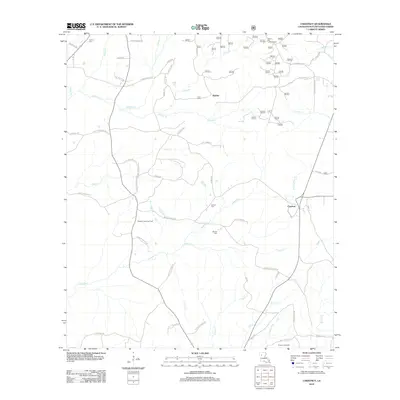
2012 Map of Chestnut
USGS Topo · Published 2012About this map
Chestnut and the surrounding pine-rich landscape of Natchitoches Parish define this 2012 topography, where the local economy transitions from small settlements like Skidder to industrial extraction. The presence of the Demery Creek Gas Field and Creston Gas Field illustrates the significance of subsurface resources in this part of Louisiana. A complex drainage network including Antoine Cr, Cypress Cr, and Demery Cr feeds into larger systems, while family-named landmarks like Hathorn Cem, Stewart Cem, and Weaver Cem provide essential anchor points for genealogists. High points such as Hickory Hill are marked by a Lookout Tower, overseeing a territory defined by timber management and rural road networks including Saint John Church Rd and Weaver Cemetery Rd.
Find a feature on this map
62 named features on this map. Tap any name to fly to it.
Don’t see what you’re looking for? This feature index may not catch every label — zoom into the map to look around manually.
Map Details
Editions of this 2012 Chestnut Map
This is the sole edition of this map. No revisions or reprints were ever made.
Other maps of this area

1937 · Campti NE
USGS Topo · 1:31,680

1937 · Campti NW
USGS Topo · 1:31,680

1944 · Campti
USGS Topo · 1:62,500

1947 · Goldonna
USGS Topo · 1:62,500

1947 · Ashland
USGS Topo · 1:62,500

1948 · Campti
USGS Topo · 1:62,500

1949 · Calvin NW
USGS Topo · 1:31,680

1953 · Alexandria
USGS Topo · 1:250,000

1955 · Shreveport
USGS Topo · 1:250,000

1955 · Alexandria
USGS Topo · 1:250,000