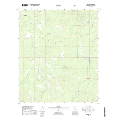
2018 Map of Chestnut
USGS Topo · Published 2018About this map
Ashland and the smaller settlements of Skidder and Chestnut anchor this portion of Natchitoches Parish, where the land is defined by the dense drainages of the Kisatchie National Forest. The landscape is a network of small watercourses like Antoine Cr, Cypress Cr, and Bayou Terry, which have historically dictated the placement of rural homesteads and connecting routes. For those tracing family histories, several burial sites are documented across the terrain, including Hathorn Cem in the northwest and Stewart Cem near the center of the quadrangle. The road network, often named for local families and landmarks such as Morgan Quick Rd, Herbert-Trichel Rd, and Esau Hamilton Rd, reflects a deeply rooted community structure tied to the forest and its seasonal creeks.
Find a feature on this map
58 named features on this map. Tap any name to fly to it.
Don’t see what you’re looking for? This feature index may not catch every label — zoom into the map to look around manually.
Map Details
Editions of this 2018 Chestnut Map
This is the sole edition of this map. No revisions or reprints were ever made.
Other maps of this area

1937 · Campti NE
USGS Topo · 1:31,680

1937 · Campti NW
USGS Topo · 1:31,680

1944 · Campti
USGS Topo · 1:62,500

1947 · Goldonna
USGS Topo · 1:62,500

1947 · Ashland
USGS Topo · 1:62,500

1948 · Campti
USGS Topo · 1:62,500

1949 · Calvin NW
USGS Topo · 1:31,680

1953 · Alexandria
USGS Topo · 1:250,000

1955 · Shreveport
USGS Topo · 1:250,000

1955 · Alexandria
USGS Topo · 1:250,000