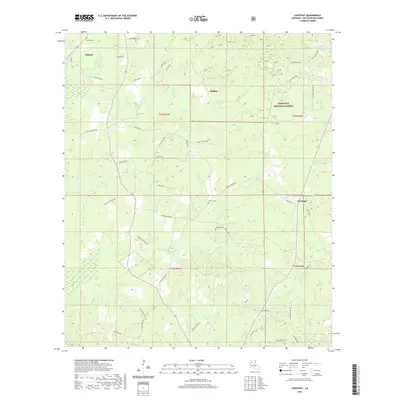
2020 Map of Chestnut
USGS Topo · Published 2020About this map
Ashland and the community of Chestnut anchor this landscape in Natchitoches Parish, where the timberlands of the Kisatchie National Forest dominate the eastern reaches. The terrain is defined by a dense network of creek drainages, including Antoine Cr, Lizzie Cr, and the winding Bayou Terry. This map reveals a rural infrastructure of named parish roads and loops that trace the local topography and property lines, such as Bumgardner Rd and Esau Hamilton Rd. For those tracing family history in this part of Louisiana, the presence of localized burial sites like Hathorn Cem, Stewart Cem, and Weaver Cem—the latter located near the southern forest boundary—points to long-established family homesteads. The small settlement of Skidder sits near the center, highlighting a pattern of small upland communities connected by forest service and county roads.
Find a feature on this map
58 named features on this map. Tap any name to fly to it.
Don’t see what you’re looking for? This feature index may not catch every label — zoom into the map to look around manually.
Map Details
Editions of this 2020 Chestnut Map
This is the sole edition of this map. No revisions or reprints were ever made.
Other maps of this area

1937 · Campti NE
USGS Topo · 1:31,680

1937 · Campti NW
USGS Topo · 1:31,680

1944 · Campti
USGS Topo · 1:62,500

1947 · Goldonna
USGS Topo · 1:62,500

1947 · Ashland
USGS Topo · 1:62,500

1948 · Campti
USGS Topo · 1:62,500

1949 · Calvin NW
USGS Topo · 1:31,680

1953 · Alexandria
USGS Topo · 1:250,000

1955 · Shreveport
USGS Topo · 1:250,000

1955 · Alexandria
USGS Topo · 1:250,000