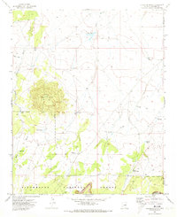
1970 Map of Chevelon Butte
USGS Topo · Published 1973About this map
Chevelon Butte dominates the high plateau landscape of this northern Arizona survey, crowned by a lookout Tower and surrounded by the Sitgreaves National Forest. The map captures a high-altitude wilderness where water management is the primary sign of human activity, defined by a network of cattle tanks and remote wells. Features such as Babbitt Tank, Mormon Tank, and Little Mormon Tank suggest the ranching heritage and movement of early settlers through this arid terrain. Deep incisions like Pablo Canyon and Chevelon Canyon cut through the forest floor, while seasonal drainages like Sand Draw and Tillman Draw provide the primary geographical structure. The presence of Garlic Well and the Big Windmill highlights the vital infrastructure required to sustain life and livestock in the Coconino backcountry before the modern era of expansion.
Find a feature on this map
27 named features on this map. Tap any name to fly to it.
Don’t see what you’re looking for? This feature index may not catch every label — zoom into the map to look around manually.
Map Details
Editions of this 1970 Chevelon Butte Map
2 editions found
Other maps of this area

1886 · Holbrook
USGS Topo · 1:250,000

1893 · Holbrook
USGS Topo · 1:250,000

1954 · Holbrook
USGS Topo · 1:250,000

1955 · Sunset Knoll 2 SW
USGS Topo · 1:24,000

1955 · Sunset Knoll 2 SE
USGS Topo · 1:24,000

1955 · Sunset Pass
USGS Topo · 1:62,500

1957 · Holbrook
USGS Topo · 1:250,000

1958 · Holbrook
USGS Topo · 1:250,000

1960 · Holbrook
USGS Topo · 1:250,000
1965 · Grama Draw
USGS Topo · 1:24,000