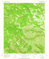
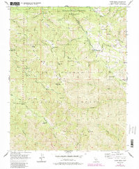
1956 Map of Chews Ridge
USGS Topo · Published 1964About this map
Los Padres National Forest forms the backdrop for this mid-century survey, revealing a landscape defined by high ridges and remote ranching outposts. The survey centers on Chews Ridge and its Chews Ridge Ranger Sta, serving as a focal point for the surrounding Hastings Natural History State Reservation. The mapping of family-named landmarks like Bruce Ranch, Mascorini Place, and Koester Ranch provides a clear view of the area's rural settlement pattern before modern development. Notable features include the curious mention of The Caves (Swimming Pool) along Church Creek, suggesting a unique recreational site deep within the canyon system. This terrain, marked by the Carmel River and its many tributaries like Piney Creek and Miller Fork, illustrates the isolation and seasonal activity of the Santa Lucia Range during this era.
Find a feature on this map
47 named features on this map. Tap any name to fly to it.
Don’t see what you’re looking for? This feature index may not catch every label — zoom into the map to look around manually.
Map Details
Editions of this 1956 Chews Ridge Map
5 editions found
Other maps of this area

1910 · Soledad
USGS Topo · 1:31,680

1915 · Soledad
USGS Topo · 1:62,500

1919 · Junipero Serra
USGS Topo · 1:62,500

1920 · Jamesburg
USGS Topo · 1:48,000

1921 · Jamesburg
USGS Topo · 1:62,500

1921 · Lucia
USGS Topo · 1:62,500

1939 · Jamesburg
USGS Topo · 1:62,500

1940 · Jamesburg
USGS Topo · 1:62,500

1940 · Soledad
USGS Topo · 1:62,500

1941 · Lucia
USGS Topo · 1:62,500