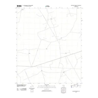
2010 Map of Cheyenne Draw SE
USGS Topo · Published 2010About this map
Isolated ranching outposts and essential water infrastructure define this section of Winkler County in the early twenty-first century. The landscape is marked by family-named holdings such as Haley Ranch, Yantis Ranch, and Willow Wells Ranch, connected by a sparse network of unpaved tracks including Haley Ranch Rd and M Cattle Co Rd. Given the arid climate of the West Texas Permian Basin, the distribution of water is the primary driver of development, evidenced by a series of critical landmarks like Lehman Windmill, North Windmill, and Parker Windmill. These features indicate the ongoing reliance on groundwater for livestock in a region where surface water is nearly nonexistent. The map provides a clear picture of modern land use in a territory where industrial-scale ranching and resource extraction are the dominant human activities.
Find a feature on this map
11 named features on this map. Tap any name to fly to it.
Don’t see what you’re looking for? This feature index may not catch every label — zoom into the map to look around manually.
Map Details
Editions of this 2010 Cheyenne Draw SE Map
This is the sole edition of this map. No revisions or reprints were ever made.
Other maps of this area

1954 · Pecos
USGS Topo · 1:250,000

1957 · Pecos
USGS Topo · 1:250,000

1967 · Soda Lake NW
USGS Topo · 1:24,000

1968 · Wink South
USGS Topo · 1:24,000

1968 · Soda Lake NE
USGS Topo · 1:24,000

1969 · Cheyenne Draw SW
USGS Topo · 1:24,000

1970 · Brunson Ranch
USGS Topo · 1:24,000

1970 · Cheyenne Draw
USGS Topo · 1:24,000

1970 · Wink North
USGS Topo · 1:24,000

1970 · Cheyenne Draw SE
USGS Topo · 1:24,000