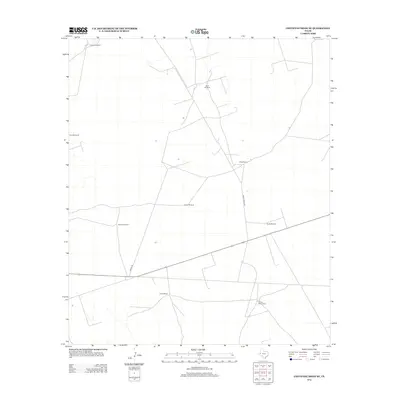
2012 Map of Cheyenne Draw SE
USGS Topo · Published 2012About this map
Haley Ranch and other family-named holdings define this arid portion of Winkler County, where the landscape is organized around essential water access. The distribution of features like Twin Windmills, Parker Windmill, and Lehman Windmill across the survey area indicates the reliance on subterranean water for livestock and remote ranch operations. Transportation is dictated by a few arterial paths such as Ranch Rd and Haley Ranch Rd, connecting isolated sites including Yantis Ranch and Willow Wells Ranch. This 2012 snapshot of West Texas cattle country preserves the specific locations of private ranching infrastructure that remains the backbone of the local rural economy.
Find a feature on this map
18 named features on this map. Tap any name to fly to it.
Don’t see what you’re looking for? This feature index may not catch every label — zoom into the map to look around manually.
Map Details
Editions of this 2012 Cheyenne Draw SE Map
This is the sole edition of this map. No revisions or reprints were ever made.
Other maps of this area

1954 · Pecos
USGS Topo · 1:250,000

1957 · Pecos
USGS Topo · 1:250,000

1967 · Soda Lake NW
USGS Topo · 1:24,000

1968 · Wink South
USGS Topo · 1:24,000

1968 · Soda Lake NE
USGS Topo · 1:24,000

1969 · Cheyenne Draw SW
USGS Topo · 1:24,000

1970 · Brunson Ranch
USGS Topo · 1:24,000

1970 · Cheyenne Draw
USGS Topo · 1:24,000

1970 · Wink North
USGS Topo · 1:24,000

1970 · Cheyenne Draw SE
USGS Topo · 1:24,000