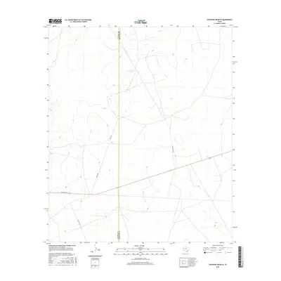
2016 Map of Cheyenne Draw SE
USGS Topo · Published 2016About this map
The high desert plains of the Permian Basin are documented here at the boundary of Loving Co and Winkler Co. This 2016 survey illustrates a landscape defined by industrial access and cattle ranching infrastructure. A network of private and ranch roads crisscrosses the terrain, notably Haley Ranch Rd and the M Cattle Co Rd, which serve the remote ranching operations and oil fields of West Texas. The primary corridor through this section of the basin is Ranch Rd 1211, cutting east-west across the topography. The sparse nature of named features reflects the open, arid character of the region, where land use is concentrated around resource extraction and large-scale livestock holdings.
Find a feature on this map
5 named features on this map. Tap any name to fly to it.
Don’t see what you’re looking for? This feature index may not catch every label — zoom into the map to look around manually.
Map Details
Editions of this 2016 Cheyenne Draw SE Map
This is the sole edition of this map. No revisions or reprints were ever made.
Other maps of this area

1954 · Pecos
USGS Topo · 1:250,000

1957 · Pecos
USGS Topo · 1:250,000

1967 · Soda Lake NW
USGS Topo · 1:24,000

1968 · Wink South
USGS Topo · 1:24,000

1968 · Soda Lake NE
USGS Topo · 1:24,000

1969 · Cheyenne Draw SW
USGS Topo · 1:24,000

1970 · Brunson Ranch
USGS Topo · 1:24,000

1970 · Cheyenne Draw
USGS Topo · 1:24,000

1970 · Wink North
USGS Topo · 1:24,000

1970 · Cheyenne Draw SE
USGS Topo · 1:24,000