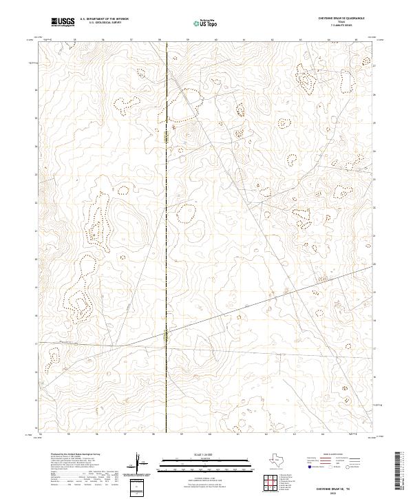
2022 Map of Cheyenne Draw SE
USGS Topo · Published 2022About this map
The boundary between Loving Co Winkler Co bisects this remote West Texas landscape, marking a transition across the arid plains of the Permian Basin. This U.S. Geological Survey representation focuses on a sparsely settled region where transportation infrastructure is defined by a few key corridors. Ranch Rd 1211 and another local Ranch Rd provide the primary access through this terrain, reflecting the modern utility of the land for ranching and industrial transit. The subtle topography and lack of named settlements highlight the character of this border region, where the vastness of the county line is the most prominent historical and administrative feature. It provides a specific look at the rural road network connecting these two counties in the early 21st century.
Find a feature on this map
3 named features on this map. Tap any name to fly to it.
Don’t see what you’re looking for? This feature index may not catch every label — zoom into the map to look around manually.
Map Details
Editions of this 2022 Cheyenne Draw SE Map
This is the sole edition of this map. No revisions or reprints were ever made.
Other maps of this area

1954 · Pecos
USGS Topo · 1:250,000

1957 · Pecos
USGS Topo · 1:250,000

1967 · Soda Lake NW
USGS Topo · 1:24,000

1968 · Wink South
USGS Topo · 1:24,000

1968 · Soda Lake NE
USGS Topo · 1:24,000

1969 · Cheyenne Draw SW
USGS Topo · 1:24,000

1970 · Brunson Ranch
USGS Topo · 1:24,000

1970 · Cheyenne Draw
USGS Topo · 1:24,000

1970 · Wink North
USGS Topo · 1:24,000

1970 · Cheyenne Draw SE
USGS Topo · 1:24,000