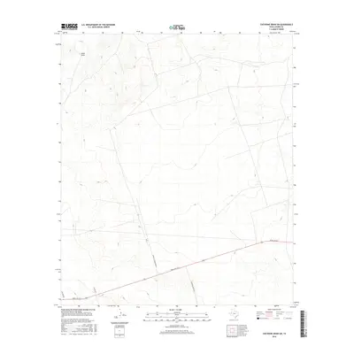
2016 Map of Cheyenne Draw SW
USGS Topo · Published 2016About this map
Rudd Draw winds through this arid expanse of Loving County, Texas, where the landscape is defined by the ephemeral drainage patterns and sparse road networks of the Permian Basin. This 2016 survey highlights the transition from traditional ranching infrastructure to the modern industrial landscape, where cattle guards and remote ranch access points intersect. The primary arterial route, Ranch Rd 1211, cuts across the lower portion of the map, providing a vital connection through this sparsely populated territory. Secondary routes with descriptive names like Purple Cattleguard Rd, Anderson Ranch Rd, and Boulder Rd reflect the local geography and the importance of specific family-named landmarks and utility crossings in navigating the vast, open terrain.
Find a feature on this map
6 named features on this map. Tap any name to fly to it.
Don’t see what you’re looking for? This feature index may not catch every label — zoom into the map to look around manually.
Map Details
Editions of this 2016 Cheyenne Draw SW Map
This is the sole edition of this map. No revisions or reprints were ever made.
Other maps of this area

1954 · Pecos
USGS Topo · 1:250,000

1957 · Pecos
USGS Topo · 1:250,000

1961 · Mentone
USGS Topo · 1:24,000

1967 · Soda Lake NW
USGS Topo · 1:24,000

1968 · Soda Lake NE
USGS Topo · 1:24,000

1969 · Cheyenne Draw SW
USGS Topo · 1:24,000

1969 · Rudd Draw NE
USGS Topo · 1:24,000
1969 · Rudd Draw
USGS Topo · 1:24,000

1970 · Brunson Ranch
USGS Topo · 1:24,000

1970 · Cheyenne Draw
USGS Topo · 1:24,000