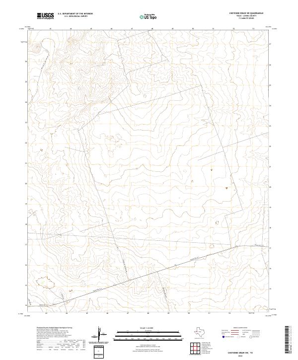
2022 Map of Cheyenne Draw SW
USGS Topo · Published 2022About this map
Rudd Draw winds through the northwestern corner of this West Texas landscape, defining the intermittent drainage patterns of Loving County. This 2022 survey illustrates a sparsely populated ranching environment where the primary infrastructure consists of a network of named ranch roads and section lines. The presence of Anderson Ranch Rd and Purple Cattleguard Rd points to the continuing legacy of large-scale cattle operations in the region. Transportation across this portion of the Permian Basin is anchored by Ranch Rd 1211, which cuts a straight path across the southern half of the map. Other local routes like Boulder Rd and Co Rd 400 branch off into the surrounding terrain, providing essential access to remote acreage and energy interests in one of the least densely populated counties in the United States.
Find a feature on this map
6 named features on this map. Tap any name to fly to it.
Don’t see what you’re looking for? This feature index may not catch every label — zoom into the map to look around manually.
Map Details
Editions of this 2022 Cheyenne Draw SW Map
This is the sole edition of this map. No revisions or reprints were ever made.
Other maps of this area

1954 · Pecos
USGS Topo · 1:250,000

1957 · Pecos
USGS Topo · 1:250,000

1961 · Mentone
USGS Topo · 1:24,000

1967 · Soda Lake NW
USGS Topo · 1:24,000

1968 · Soda Lake NE
USGS Topo · 1:24,000

1969 · Cheyenne Draw SW
USGS Topo · 1:24,000

1969 · Rudd Draw NE
USGS Topo · 1:24,000
1969 · Rudd Draw
USGS Topo · 1:24,000

1970 · Brunson Ranch
USGS Topo · 1:24,000

1970 · Cheyenne Draw
USGS Topo · 1:24,000