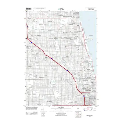
2012 Map of Chicago Loop
USGS Topo · Published 2012About this map
Lake Michigan dominates the eastern edge of this dense urban corridor, where the historic shoreline is defined by recreational landmarks like Waveland Avenue Golf Course and industrial beacons such as the William E Dever Crib Light. The interior landscape reveals the layered growth of the city through its numerous educational institutions and sprawling burial grounds. Major cemeteries including Rosehill Cem and Graceland Cem provide significant green space amidst the grid, while Wrigley Field anchors the North Side community. The North Branch Chicago River winds through the heart of the area, passing Goose Island and converging at The Forks near the massive Merchandise Mart. From the academic hubs of DePaul University and Loyola University-Water Tower Campus to the residential enclaves of Ravenswood and Uptown, the map illustrates a highly developed metropolitan center at a point of modern maturity.
Find a feature on this map
290 named features on this map. Tap any name to fly to it.
Don’t see what you’re looking for? This feature index may not catch every label — zoom into the map to look around manually.
Map Details
Editions of this 2012 Chicago Loop Map
This is the sole edition of this map. No revisions or reprints were ever made.
Other maps of this area

1889 · Chicago
USGS Topo · 1:62,500

1891 · Chicago
USGS Topo · 1:62,500

1891 · Riverside
USGS Topo · 1:62,500

1893 · Riverside
USGS Topo · 1:62,500

1899 · Evanston
USGS Topo · 1:62,500

1900 · Chicago
USGS Topo · 1:62,500

1900 · Riverside
USGS Topo · 1:62,500

1900 · Highwood
USGS Topo · 1:62,500

1901 · Riverside
USGS Topo · 1:62,500

1901 · Chicago
USGS Topo · 1:62,500
Featured Places
- Chicago, IL
- Lincolnwood, IL
- Jefferson Township, Chicago
- West Chicago Township, Chicago
- Niles Township, IL