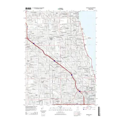
2015 Map of Chicago Loop
USGS Topo · Published 2015About this map
Dense urban neighborhoods and lakefront beaches define this portrait of the North Side, where the North Branch Chicago River and North Shore Channel cut through the city grid. The landscape is marked by substantial commemorative spaces and academic institutions, from the sprawling grounds of Rosehill Cem and its notable Rosehill Mausoleum to the campus of Loyola Univ Chicago perched near Hayes Point. Along the Lake Michigan shoreline, a string of public spaces like Foster Avenue Beach and Montrose-Wilson Beach provide a buffer between the water and the residential blocks of Uptown and Edgewater. Further inland, the map documents distinct historical enclaves such as Ravenswood Manor, Ravenswood Gardens, and the industrial character near the Cortland Street Bridge. This survey illustrates the intricate balance between Chicago's massive park system, its rail infrastructure including the Chicago Loop, and its diverse residential districts.
Find a feature on this map
221 named features on this map. Tap any name to fly to it.
Don’t see what you’re looking for? This feature index may not catch every label — zoom into the map to look around manually.
Map Details
Editions of this 2015 Chicago Loop Map
This is the sole edition of this map. No revisions or reprints were ever made.
Other maps of this area

1889 · Chicago
USGS Topo · 1:62,500

1891 · Chicago
USGS Topo · 1:62,500

1891 · Riverside
USGS Topo · 1:62,500

1893 · Riverside
USGS Topo · 1:62,500

1899 · Evanston
USGS Topo · 1:62,500

1900 · Chicago
USGS Topo · 1:62,500

1900 · Riverside
USGS Topo · 1:62,500

1900 · Highwood
USGS Topo · 1:62,500

1901 · Riverside
USGS Topo · 1:62,500

1901 · Chicago
USGS Topo · 1:62,500
Featured Places
- Chicago, IL
- Lincolnwood, IL
- Jefferson Township, Chicago
- West Chicago Township, Chicago
- Niles Township, IL