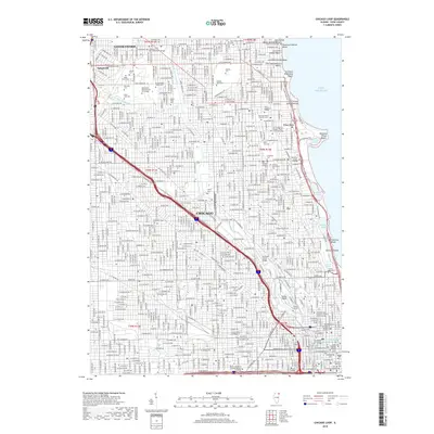
2018 Map of Chicago Loop
USGS Topo · Published 2018About this map
Chicago's north side and the dense urban core of the Loop are presented in high detail, illustrating a landscape defined by its lakefront and the industrial heritage of the Chicago River. The map documents a significant concentration of historic cemeteries and mausoleums, including the expansive grounds of Rosehill Cem, the renowned Graceland Cem, and the Bohemian National Cem of Chicago. These sites, along with the Rosehill Mausoleum and the Getty Tomb, serve as critical points for local historians and genealogists studying the city's late 19th and early 20th-century development.
Find a feature on this map
240 named features on this map. Tap any name to fly to it.
Don’t see what you’re looking for? This feature index may not catch every label — zoom into the map to look around manually.
Map Details
Editions of this 2018 Chicago Loop Map
This is the sole edition of this map. No revisions or reprints were ever made.
Other maps of this area

1889 · Chicago
USGS Topo · 1:62,500

1891 · Chicago
USGS Topo · 1:62,500

1891 · Riverside
USGS Topo · 1:62,500

1893 · Riverside
USGS Topo · 1:62,500

1899 · Evanston
USGS Topo · 1:62,500

1900 · Chicago
USGS Topo · 1:62,500

1900 · Riverside
USGS Topo · 1:62,500

1900 · Highwood
USGS Topo · 1:62,500

1901 · Riverside
USGS Topo · 1:62,500

1901 · Chicago
USGS Topo · 1:62,500
Featured Places
- Chicago, IL
- Lincolnwood, IL
- Jefferson Township, Chicago
- West Chicago Township, Chicago
- Niles Township, IL