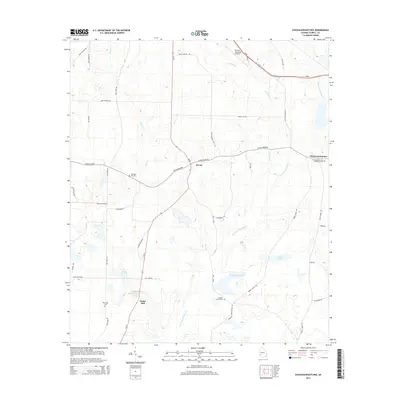
2014 Map of Chickasawhatchee
USGS Topo · Published 2014About this map
Clarks Mill and the surrounding Terrell County landscape are defined by a network of creeks and small lakes feeding into the Chickasawhatchee Cr. This 2014 survey captures the rural character of the region, where the historical settlement at Herod sits at the junction of the Herod Dover Rd and Sasser-Herod Rd. The map illustrates the persistent importance of water management in this agricultural area, anchored by the Clarks Millpond Dam and numerous named water bodies like Laing Lake and Featherfield Lake. Genealogists will find significant value in the distribution of local burial grounds, including the Chickasawhatchee Methodist Cem, Pleasant Hill Cem, and Houston Grove Cem. Transportation is concentrated along Us-82 and Ga-55, while the Dawson Municipal Airport marks the northern edge of the quadrangle.
Find a feature on this map
44 named features on this map. Tap any name to fly to it.
Don’t see what you’re looking for? This feature index may not catch every label — zoom into the map to look around manually.
Map Details
Editions of this 2014 Chickasawhatchee Map
This is the sole edition of this map. No revisions or reprints were ever made.
Other maps of this area

1953 · Dothan
USGS Topo · 1:250,000

1954 · Dothan
USGS Topo · 1:250,000

1955 · Dothan
USGS Topo · 1:250,000

1956 · Sasser
USGS Topo · 1:62,500

1972 · Shellman
USGS Topo · 1:24,000

1973 · Morgan
USGS Topo · 1:24,000

1973 · Chickasawhatchee
USGS Topo · 1:24,000

1973 · Sasser
USGS Topo · 1:24,000

1973 · Pretoria
USGS Topo · 1:24,000

1973 · Dawson
USGS Topo · 1:24,000