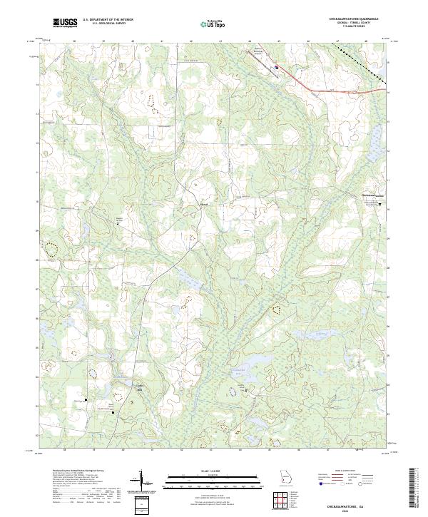
2024 Map of Chickasawhatchee
USGS Topo · Published 2024About this map
Chickasawhatchee Creek and its many tributaries define the drainage of this Southwest Georgia landscape, where agricultural tradition and small crossroads communities persist. The settlement of Chickasawhatchee sits in the northeast corner, while Herod occupies the central western portion, linked by rural routes like Sasser Herod Rd. Genealogists will find a high concentration of burial sites, including the Chickasawhatchee Methodist Cem and the Green Grove Baptist Church Cem. The southern reach of the quadrangle is marked by hydrological features such as Clarks Mill and the Clarks Millpond Dam, alongside named waters like Featherfield Lake and Long Pond. This modern survey documents the legacy of family landholdings and religious centers that have long shaped Terrell County, showing how the wetlands surrounding Herod Creek and Brantley Creek continue to influence local development and land use patterns.
Find a feature on this map
24 named features on this map. Tap any name to fly to it.
Don’t see what you’re looking for? This feature index may not catch every label — zoom into the map to look around manually.
Map Details
Editions of this 2024 Chickasawhatchee Map
This is the sole edition of this map. No revisions or reprints were ever made.
Other maps of this area

1953 · Dothan
USGS Topo · 1:250,000

1954 · Dothan
USGS Topo · 1:250,000

1955 · Dothan
USGS Topo · 1:250,000

1956 · Sasser
USGS Topo · 1:62,500

1972 · Shellman
USGS Topo · 1:24,000

1973 · Morgan
USGS Topo · 1:24,000

1973 · Chickasawhatchee
USGS Topo · 1:24,000

1973 · Sasser
USGS Topo · 1:24,000

1973 · Pretoria
USGS Topo · 1:24,000

1973 · Dawson
USGS Topo · 1:24,000