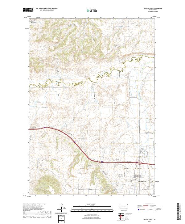
2021 Map of Chicken Creek
USGS Topo · Published 2021About this map
The boundary between Butte and Lawrence counties runs through this landscape, dominated by the northern extent of Spearfish and the adjacent community of North Spearfish. The terrain is defined by a complex network of water management and natural drainage, including the Redwater River and Spearfish Cr. The agricultural history of the region is evident in named irrigation features like Cook Ditch, Carlson Ditch, and Herber Ditch, which redirect water across the plains south of the river. To the west, the landscape transitions into more varied topography, including the steep depths of Big Canyon and the riparian areas surrounding Chicken Cr and Lake Cr. Smaller bodies of water such as Cox Lake and Mud Lake dot the western reaches, while the southern portion of the sheet rises toward the higher elevations of Higgins Gulch, illustrating the transition from the Black Hills toward the northern prairies.
Find a feature on this map
79 named features on this map. Tap any name to fly to it.
Don’t see what you’re looking for? This feature index may not catch every label — zoom into the map to look around manually.
Map Details
Editions of this 2021 Chicken Creek Map
This is the sole edition of this map. No revisions or reprints were ever made.
Other maps of this area

1894 · Deadwood
USGS Topo · 1:125,000

1898 · Sundance
USGS Topo · 1:125,000

1900 · Spearfish
USGS Topo · 1:62,500

1901 · Deadwood
USGS Topo · 1:125,000

1901 · Aladdin
USGS Topo · 1:125,000

1902 · Sundance
USGS Topo · 1:125,000

1903 · Aladdin
USGS Topo · 1:125,000

1907 · Belle Fourche
USGS Topo · 1:125,000

1907 · Redwater
USGS Topo · 1:62,500

1915 · Spearfish
USGS Topo · 1:62,500