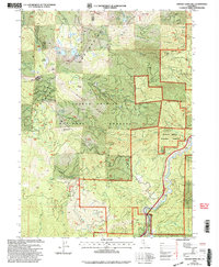
1998 Map of Chicken Hawk Hill
USGS Topo · Published 2003About this map
Stuckeys Place and Baker Hollow mark the few established points of settlement in this high-elevation landscape of the Shasta Trinity National Forests. The terrain is defined by the sharp transition between the Sacramento River canyon and the surrounding peaks, with numerous high-altitude water bodies like Tamarack Lake and Grey Rock Lake tucked beneath the Grey Rocks.
Find a feature on this map
32 named features on this map. Tap any name to fly to it.
Don’t see what you’re looking for? This feature index may not catch every label — zoom into the map to look around manually.
Map Details
Editions of this 1998 Chicken Hawk Hill Map
This is the sole edition of this map. No revisions or reprints were ever made.
Other maps of this area

1886 · Shasta
USGS Topo · 1:250,000

1890 · Red Bluff
USGS Topo · 1:250,000

1894 · Red Bluff
USGS Topo · 1:250,000

1894 · Shasta
USGS Topo · 1:250,000

1901 · Redding
USGS Topo · 1:125,000

1913 · Weaverville
USGS Topo · 1:125,000

1923 · Sawyers Bar
USGS Topo · 1:125,000

1931 · Etna
USGS Topo · 1:96,000

1934 · Etna
USGS Topo · 1:125,000

1935 · Dunsmuir
USGS Topo · 1:125,000