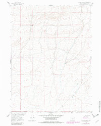
1960 Map of Chicken Spring
USGS Topo · Published 1982About this map
Chicken Spring and its surrounding high-plains terrain dominate this landscape in Sweetwater County, documented during the 1960s with revisions made in the early 1980s. The area is defined by seasonal watercourses and the infrastructure of ranching, most notably the Hadsell Corral located near the southern edge of the sheet. The drainage patterns of Spring Creek and Stewart Creek illustrate the typical hydrology of the Wyoming desert, where water sources were critical for both livestock and early travelers. This map captures a moment in the mid-20th century before significant industrial development, showing only a lone Well and primitive trails through the sagebrush-covered hills. The topography reveals the subtle shifts in elevation across the Great Divide Basin, a region where internal drainage and remote outposts like the corral were the primary markers of human activity.
Find a feature on this map
9 named features on this map. Tap any name to fly to it.
Don’t see what you’re looking for? This feature index may not catch every label — zoom into the map to look around manually.
Map Details
Editions of this 1960 Chicken Spring Map
3 editions found
Other maps of this area

1954 · Rawlins
USGS Topo · 1:250,000

1955 · Casper
USGS Topo · 1:250,000

1958 · Rawlins
USGS Topo · 1:250,000

1958 · Casper
USGS Topo · 1:250,000

1960 · Hansen Lake NE
USGS Topo · 1:24,000

1960 · Sooner Reservoir
USGS Topo · 1:24,000

1960 · Larsen Knoll
USGS Topo · 1:24,000

1960 · Bull Springs
USGS Topo · 1:24,000

1960 · Buck Draw
USGS Topo · 1:24,000

1960 · Chicken Spring
USGS Topo · 1:24,000