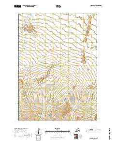
2020 Map of Chignik B-4 NW
USGS Topo · Published 2020About this map
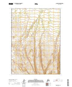
Blueberry Creek and Fireweed Creek define the drainage patterns of this Alaskan landscape within the Lake and Peninsula Borough. The topography is anchored by the prominent Rifle Butte, which rises as a significant landmark above the surrounding terrain. This remote stretch of the Alaska Peninsula is characterized by its glacial and fluvial geography, where small creek systems cut through land partitioned into large township and range blocks such as t43s r63w and t44s r64w. The map provides a detailed view of the natural watercourses and elevation changes in a region where human infrastructure like roads and permanent settlements are entirely absent, reflecting the wilderness character of the Chignik area.
Find a feature on this map
9 named features on this map. Tap any name to fly to it.
Don’t see what you’re looking for? This feature index may not catch every label — zoom into the map to look around manually.
Map Details
Editions of this 2020 Chignik B-4 NW Map
This is the sole edition of this map. No revisions or reprints were ever made.
Other maps of this area

1963 · Chignik C-4
USGS Topo · 1:63,360

1963 · Chignik B-5
USGS Topo · 1:63,360

1963 · Chignik B-4
USGS Topo · 1:63,360

1963 · Chignik C-5
USGS Topo · 1:63,360

1963 · Chignik
USGS Topo · 1:250,000
2020 · Chignik B-4 SW
USGS Topo · 1:25,000
2020 · Chignik B-5 NE
USGS Topo · 1:25,000
2020 · Chignik C-4 SW
USGS Topo · 1:25,000
2020 · Chignik B-5 SE
USGS Topo · 1:25,000
2020 · Chignik C-4 SE
USGS Topo · 1:25,000