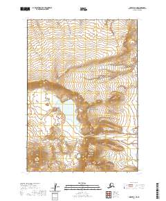
2020 Map of Chignik D-1 NE
USGS Topo · Published 2020About this map
Aniakchak Crater dominates this 2020 survey, revealing the dramatic topography within the Aniakchak National Monument. The basin floor is marked by volcanic features like Vent Mtn and the waters of Surprise Lake, which feeds the Aniakchak River. The river's path through the caldera wall is defined by The Gates, a narrow breach that allows the Aniakchak Wild and Scenic River to flow southeast toward the coast. This map illustrates the intersection of geological activity and hydrography, where the sheer walls of the crater meet landmarks like Black Nose. The lack of human infrastructure highlights the primitive state of this landscape, preserved for its unique volcanic and riparian systems.
Find a feature on this map
13 named features on this map. Tap any name to fly to it.
Don’t see what you’re looking for? This feature index may not catch every label — zoom into the map to look around manually.
Map Details
Editions of this 2020 Chignik D-1 NE Map
This is the sole edition of this map. No revisions or reprints were ever made.
Other maps of this area

1943 · Ugashik
USGS Topo · 1:250,000

1948 · Ugashik
USGS Topo · 1:250,000

1949 · Ugashik
USGS Topo · 1:250,000

1951 · Bristol Bay
USGS Topo · 1:250,000

1951 · Sutwik Island
USGS Topo · 1:250,000

1963 · Ugashik A-6
USGS Topo · 1:63,360

1963 · Bristol Bay
USGS Topo · 1:250,000

1963 · Bristol Bay A-1
USGS Topo · 1:63,360

1963 · Sutwik Island
USGS Topo · 1:250,000

1963 · Chignik
USGS Topo · 1:250,000