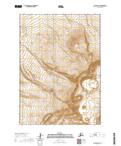
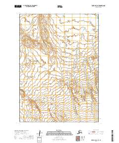
2020 Map of Chignik D-1 NW
USGS Topo · Published 2020About this map
Aniakchak National Monument defines the eastern portion of this landscape on the Alaska Peninsula, where the volcanic topography is punctuated by the distinct Half Cone formation. The terrain is characterized by a complex network of drainages including Mud Cr in the northeast and Reindeer Cr to the southwest, illustrating the hydraulic patterns of this protected wilderness. In the western reaches, the Alaska Peninsula National Wildlife Refuge encompasses several townships, marking a significant conservation boundary. This 2020 survey provides precise elevation contours and public land survey system divisions, such as t37s r56w and t38s r57w, which are essential for navigating and managing these remote federal lands. The map details the transition from the volcanic features of the monument to the sensitive habitats within the wildlife refuge, grounded by the seasonal flow of Barabara Cr in the south.
Find a feature on this map
10 named features on this map. Tap any name to fly to it.
Don’t see what you’re looking for? This feature index may not catch every label — zoom into the map to look around manually.
Map Details
Editions of this 2020 Chignik D-1 NW Map
This is the sole edition of this map. No revisions or reprints were ever made.
Other maps of this area

1951 · Bristol Bay
USGS Topo · 1:250,000

1963 · Bristol Bay
USGS Topo · 1:250,000
1963 · Bristol Bay A-2
USGS Topo · 1:63,360

1963 · Bristol Bay A-1
USGS Topo · 1:63,360

1963 · Chignik
USGS Topo · 1:250,000

1963 · Chignik D-1
USGS Topo · 1:63,360

1963 · Chignik D-2
USGS Topo · 1:63,360
1967 · Bristol Bay
USGS Topo · 1:250,000
2019 · Bristol Bay A-1 SE
USGS Topo · 1:25,000
2019 · Bristol Bay A-2 SE
USGS Topo · 1:25,000