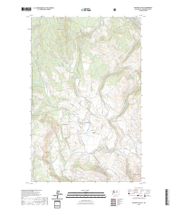
2023 Map of Chiliwist Valley
USGS Topo · Published 2023About this map
Chiliwist Valley and the small settlement of Olema define this portion of Okanogan County, where the landscape transitions from the protected timberlands of the Okanogan National Forest to managed water resources and ranching terrain. The topography is anchored by significant elevations such as Woody Mtn and Cook Mtn in the north, giving way to the deep incisions of Rowel Canyon further south. Water management is a primary feature of the valley floor, evidenced by the Stout Reservoir and the drainage network of Sullivan Creek and Chiliwist Creek. A network of forest and county roads, including Chiliwist Rd and Olema Rd, provides access to the high points and terminal landmarks like Rattlesnake Point. This survey details the modern layout of these remote mountain drainages, illustrating the continued reliance on the natural creek systems for local geography and naming.
Find a feature on this map
28 named features on this map. Tap any name to fly to it.
Don’t see what you’re looking for? This feature index may not catch every label — zoom into the map to look around manually.
Map Details
Editions of this 2023 Chiliwist Valley Map
This is the sole edition of this map. No revisions or reprints were ever made.
Other maps of this area

1905 · Okanogan
USGS Topo · 1:125,000

1954 · Okanogan
USGS Topo · 1:250,000

1956 · Loup Loup
USGS Topo · 1:62,500

1957 · Okanogan
USGS Topo · 1:62,500

1957 · Bridgeport
USGS Topo · 1:62,500

1957 · Brewster
USGS Topo · 1:62,500

1958 · Okanogan
USGS Topo · 1:250,000
1980 · Monse
USGS Topo · 1:24,000
1980 · Ruby Hill
USGS Topo · 1:24,000
1981 · Malott
USGS Topo · 1:24,000