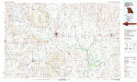
1981 Map of Chillicothe
USGS Topo · Published 1981About this map
Chillicothe serves as the central hub of this North Missouri landscape, where the confluence of the Grand River and Thompson River dictates the region's geography. The map illustrates a complex convergence of mid-century transportation and conservation, featuring the primary lines of the Burlington Northern, Norfolk and Western, and Chicago Milwaukee St Paul and Pacific railroads. These rail corridors link rural trade centers like Brookfield, Hamilton, and Gallatin.
Find a feature on this map
75 named features on this map. Tap any name to fly to it.
Don’t see what you’re looking for? This feature index may not catch every label — zoom into the map to look around manually.
Map Details
Editions of this 1981 Chillicothe Map
This is the sole edition of this map. No revisions or reprints were ever made.
Other maps of this area

1889 · Lexington
USGS Topo · 1:125,000

1890 · Glasgow
USGS Topo · 1:125,000

1890 · Marshall
USGS Topo · 1:125,000

1892 · Marshall
USGS Topo · 1:125,000

1894 · Independence
USGS Topo · 1:125,000

1901 · Marshall
USGS Topo · 1:125,000

1921 · Chillicothe
USGS Topo · 1:62,500

1922 · Gallatin
USGS Topo · 1:62,500

1923 · Chillicothe
USGS Topo · 1:62,500

1924 · Polo
USGS Topo · 1:62,500