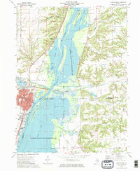
1972 Map of Chillicothe
USGS Topo · Published 1974About this map
The Illinois River serves as the central artery of this Illinois landscape, defining the boundaries between Peoria, Marshall, and Woodford counties in the early 1970s. The bustling riverfront at Chillicothe is characterized by its industrial and recreational infrastructure, including a marina, multiple gravel pits, and extensive rail networks like the Chicago Rock Island and Pacific. This era captures the town's established educational footprint with the Lincoln Valley Central High Sch and Truitt Sch serving the local population.
Find a feature on this map
60 named features on this map. Tap any name to fly to it.
Don’t see what you’re looking for? This feature index may not catch every label — zoom into the map to look around manually.
Map Details
Editions of this 1972 Chillicothe Map
2 editions found
Other maps of this area

1893 · Lacon
USGS Topo · 1:62,500

1893 · Metamora
USGS Topo · 1:62,500

1893 · Dunlap
USGS Topo · 1:62,500

1898 · Dunlap
USGS Topo · 1:62,500

1932 · Dunlap
USGS Topo · 1:62,500

1933 · Dunlap
USGS Topo · 1:62,500

1933 · Lacon
USGS Topo · 1:62,500

1933 · Camp Grove
USGS Topo · 1:48,000

1937 · Metamora
USGS Topo · 1:62,500

1937 · Dunlap
USGS Topo · 1:62,500