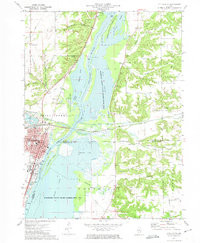
1972 Map of Chillicothe
USGS Topo · Published 1974About this map
The Illinois River corridor dominates this 1970s landscape, shaped by a complex network of backwater lakes and conservation areas spanning Peoria, Marshall, and Woodford counties. The city of Chillicothe serves as the primary hub, where the Chicago Rock Island and Pacific and the Atchison Topeka and Santa Fe railroads intersect near the riverbank. This era shows the expansion of the Marshall County State Conservation Area and Woodford County State Conservation Area, protecting vital wetlands like Wightman Lake and Meadow Lake. Local landmarks such as Lincoln Valley Central High Sch and the residential layout of Rome provide a detailed look at mid-century community development. Small rural cemeteries like Hammett Cem and Babb Cem are preserved in the surrounding hills and hollows, including Hardscrabble Hollow, offering valuable points of interest for genealogists tracing local families.
Find a feature on this map
53 named features on this map. Tap any name to fly to it.
Don’t see what you’re looking for? This feature index may not catch every label — zoom into the map to look around manually.
Map Details
Editions of this 1972 Chillicothe Map
2 editions found
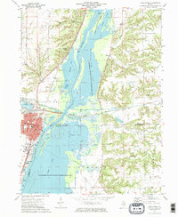
Other maps of this area

1893 · Lacon
USGS Topo · 1:62,500

1893 · Metamora
USGS Topo · 1:62,500

1893 · Dunlap
USGS Topo · 1:62,500

1898 · Dunlap
USGS Topo · 1:62,500

1932 · Dunlap
USGS Topo · 1:62,500

1933 · Dunlap
USGS Topo · 1:62,500

1933 · Lacon
USGS Topo · 1:62,500

1933 · Camp Grove
USGS Topo · 1:48,000

1937 · Metamora
USGS Topo · 1:62,500

1937 · Dunlap
USGS Topo · 1:62,500