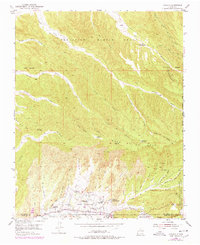
1953 Map of Chimayo
USGS Topo · Published 1978About this map
The settlement of Chimayo and the surrounding high-desert landscape are documented here as they appeared in the early 1950s. This land is deeply marked by Spanish land grant history, including the Sebastian Martin Grant and the Santa Cruz Grant, which define property boundaries and community patterns. The agricultural life of the valley is visible through the intricate system of ditches and small villages like Los Pachecos and El Rincon de los Trujillos situated along the Santa Cruz River. Cultural history is anchored by the Capilla de Santa Rita, while ancient habitation is evidenced by Pueblo Ruins located north of the river. The topography is defined by a complex network of arroyos and cañadas, such as Arroyo del Palacio and Cañada Ancha, cutting through the Mesa de la Ceja.
Find a feature on this map
52 named features on this map. Tap any name to fly to it.
Don’t see what you’re looking for? This feature index may not catch every label — zoom into the map to look around manually.
Map Details
Editions of this 1953 Chimayo Map

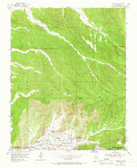
Other maps of this area

1889 · Santa Fe
USGS Topo · 1:125,000

1892 · Santa Clara
USGS Topo · 1:125,000

1894 · Santa Fe
USGS Topo · 1:125,000

1918 · Abiquiu
USGS Topo · 1:125,000

1953 · Espanola
USGS Topo · 1:24,000

1953 · San Juan Pueblo
USGS Topo · 1:24,000

1953 · Lyden
USGS Topo · 1:24,000

1953 · Truchas
USGS Topo · 1:24,000

1953 · Velarde
USGS Topo · 1:24,000

1953 · Sierra Mosca
USGS Topo · 1:24,000