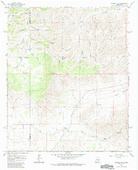
1965 Map of Chimney Lake
USGS Topo · Published 1985About this map
The boundary between Otero and Chaves counties bisects this high-desert landscape, where the rugged canyons of the Lincoln National Forest meet the flatter draws of the eastern plains. Ranching life defines the geography of the mid-1960s, with a network of dispersed homesteads and vital water infrastructure sustaining the area. Named sites like McGuire Ranch, Jernigan Ranch, and the Van Cleve Ranch serve as primary landmarks across the varied terrain. The map documents an essential reliance on artificial and natural water sources, ranging from Boyce Tank and Home Tank to the namesake Chimney Lake. Landforms such as Chimney Peak and One Tree Peak rise above a system of drainage features including Cuevo Creek and Barclay Draw, providing a detailed look at the hydrology of the New Mexico interior during this era.
Find a feature on this map
32 named features on this map. Tap any name to fly to it.
Don’t see what you’re looking for? This feature index may not catch every label — zoom into the map to look around manually.
Map Details
Editions of this 1965 Chimney Lake Map
2 editions found
Other maps of this area

1954 · Carlsbad
USGS Topo · 1:250,000

1958 · Carlsbad
USGS Topo · 1:250,000

1962 · Dunken
USGS Topo · 1:62,500

1963 · Cornucopia Canyon
USGS Topo · 1:24,000

1963 · Robertson Canyon
USGS Topo · 1:24,000

1963 · Woodson Canyon
USGS Topo · 1:24,000

1965 · Chimney Lake
USGS Topo · 1:24,000

1965 · Lewis Peak
USGS Topo · 1:24,000

1965 · Avis
USGS Topo · 1:24,000

1965 · Pinon
USGS Topo · 1:24,000