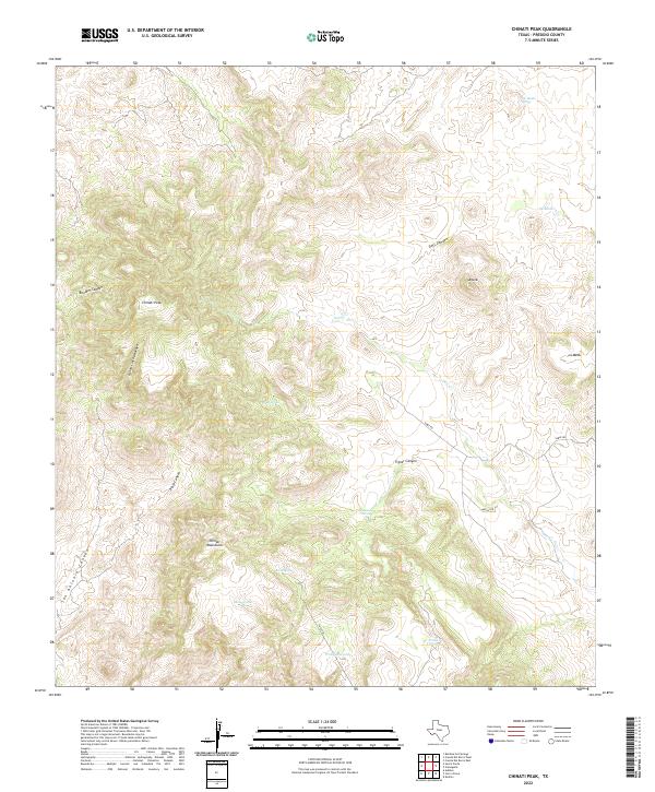
2022 Map of Chinati Peak
USGS Topo · Published 2022About this map
Chinati Peak dominates this high-altitude section of the Chinati Mountains in Presidio County, providing a detailed look at the drainage patterns and water sources critical to this arid region. The map reveals a network of canyons and arroyos, including Boulder Canyon, Doll Canyon, and the deep Pinto Canyon, which serve as the primary conduits for runoff toward Oso Cr. Isolated water sources such as Ojo Bonito Spring, Bull Spring, and Deck Spring are identified alongside cattle tanks and small reservoirs like Presa Viruelas and Mesa Tank. These scattered features, connected by routes like Sable Rd and the Pack Trl, suggest a landscape shaped by intermittent water availability and ranching operations. The presence of Ojo Agua Zarca and Presa Rincon further highlights the human efforts to capture and manage the region's sparse natural springs.
Find a feature on this map
22 named features on this map. Tap any name to fly to it.
Don’t see what you’re looking for? This feature index may not catch every label — zoom into the map to look around manually.
Map Details
Editions of this 2022 Chinati Peak Map
This is the sole edition of this map. No revisions or reprints were ever made.
Other maps of this area

1895 · Marfa
USGS Topo · 1:125,000

1896 · Ruidosa
USGS Topo · 1:125,000

1896 · San Carlos
USGS Topo · 1:125,000

1896 · Shafter
USGS Topo · 1:125,000

1959 · Presidio
USGS Topo · 1:250,000

1959 · Marfa
USGS Topo · 1:250,000

1965 · Presidio
USGS Topo · 1:250,000

1965 · Marfa
USGS Topo · 1:250,000

1966 · Adobes
USGS Topo · 1:24,000

1978 · Sierra Parda
USGS Topo · 1:24,000