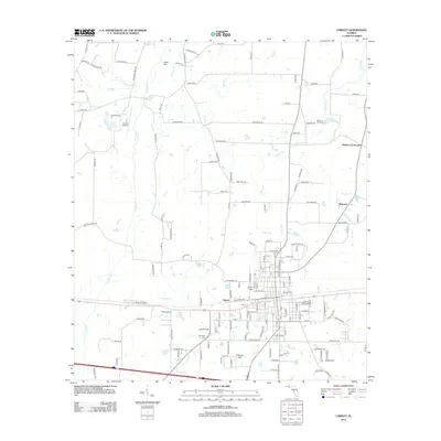
2012 Map of Chipley
USGS Topo · Published 2012About this map
Holmes Creek and its diverse tributaries like Reddick Mill Creek and Titi Branch define the drainage patterns of this Washington County landscape. The road network centers on the gridded streets of the primary settlement, which is flanked by outlying locations such as Hulaw, Bahoma, and Richter Crossroads. Local aviation is well-represented by the presence of both the Tri-County Airport and Vosika's Airport, indicating the region's role as a transportation hub for the Florida Panhandle.
Find a feature on this map
145 named features on this map. Tap any name to fly to it.
Don’t see what you’re looking for? This feature index may not catch every label — zoom into the map to look around manually.
Map Details
Editions of this 2012 Chipley Map
This is the sole edition of this map. No revisions or reprints were ever made.
Other maps of this area

1950 · Chipley
USGS Topo · 1:24,000

1950 · Wausau
USGS Topo · 1:24,000

1950 · Esto
USGS Topo · 1:24,000

1950 · Poplar Head
USGS Topo · 1:24,000

1951 · Graceville
USGS Topo · 1:24,000

1951 · Esto
USGS Topo · 1:24,000

1951 · Chipley
USGS Topo · 1:24,000

1951 · Wausau
USGS Topo · 1:24,000
1951 · Poplar Head
USGS Topo · 1:24,000

1951 · Bonifay
USGS Topo · 1:24,000