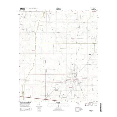
2015 Map of Chipley
USGS Topo · Published 2015About this map
Chipley serves as the central hub of this Florida Panhandle landscape, where the L & N RR corridor intersects with a network of local roads and waterways. The town's grid expands toward the small communities of Hulaw and Bahoma, while Richter Crossroads marks a key junction to the northeast. This area sits at a triple-county border, where Holmes, Jackson, and Washington counties converge.
Find a feature on this map
140 named features on this map. Tap any name to fly to it.
Don’t see what you’re looking for? This feature index may not catch every label — zoom into the map to look around manually.
Map Details
Editions of this 2015 Chipley Map
This is the sole edition of this map. No revisions or reprints were ever made.
Other maps of this area

1950 · Chipley
USGS Topo · 1:24,000

1950 · Wausau
USGS Topo · 1:24,000

1950 · Esto
USGS Topo · 1:24,000

1950 · Poplar Head
USGS Topo · 1:24,000

1951 · Graceville
USGS Topo · 1:24,000

1951 · Esto
USGS Topo · 1:24,000

1951 · Chipley
USGS Topo · 1:24,000

1951 · Wausau
USGS Topo · 1:24,000
1951 · Poplar Head
USGS Topo · 1:24,000

1951 · Bonifay
USGS Topo · 1:24,000