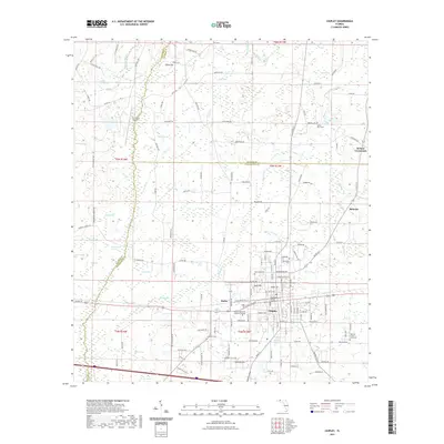
2021 Map of Chipley
USGS Topo · Published 2021About this map
The Washington County Courthouse serves as the focal point for Chipley, a regional hub where the L & N RR and modern highways intersect. This 2021 study illustrates a landscape defined by its complex hydrography, featuring numerous "bays" or swampy depressions such as Double Spring Bay, Rattlesnake Bay, and Hurricane Bay. These wetlands, often named for local flora or fauna, weave between higher ground like Hicks Hill and Nearing Hill, shaping the development of outlying settlements like Hulaw and Bahoma.
Find a feature on this map
155 named features on this map. Tap any name to fly to it.
Don’t see what you’re looking for? This feature index may not catch every label — zoom into the map to look around manually.
Map Details
Editions of this 2021 Chipley Map
This is the sole edition of this map. No revisions or reprints were ever made.
Other maps of this area

1950 · Chipley
USGS Topo · 1:24,000

1950 · Wausau
USGS Topo · 1:24,000

1950 · Esto
USGS Topo · 1:24,000

1950 · Poplar Head
USGS Topo · 1:24,000

1951 · Graceville
USGS Topo · 1:24,000

1951 · Esto
USGS Topo · 1:24,000

1951 · Chipley
USGS Topo · 1:24,000

1951 · Wausau
USGS Topo · 1:24,000
1951 · Poplar Head
USGS Topo · 1:24,000

1951 · Bonifay
USGS Topo · 1:24,000