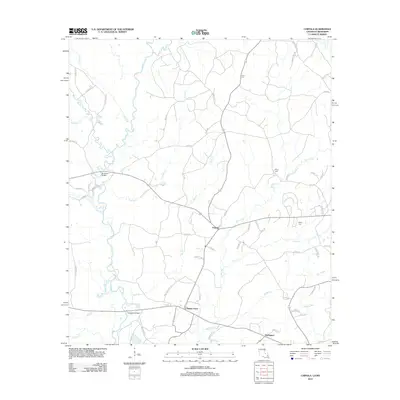
2012 Map of Chipola
USGS Topo · Published 2012About this map
The Amite River and its numerous tributaries, including the E Fork Amite River and W Fork Amite River, create a dense hydrological network throughout this portion of Saint Helena Parish. This 2012 survey shows a landscape defined by small settlements and rural road systems, where Chipola sits as a central point of intersection. Further south, Coleman Town and Darlington mark the lower reaches of the map near the winding Sandy Run. Genealogists may find particular value in the several documented burial sites that dot the area, such as Hurst Cem, Kemp Cem, and Wales Cem. The road network is heavily influenced by the meandering paths of Buck Cr and Joiner Cr, with routes like Fred Butler Rd and Otis and Willie Matthews Rd connecting family lands and local communities in this piney woods region of the Louisiana-Mississippi border.
Find a feature on this map
67 named features on this map. Tap any name to fly to it.
Don’t see what you’re looking for? This feature index may not catch every label — zoom into the map to look around manually.
Map Details
Editions of this 2012 Chipola Map
This is the sole edition of this map. No revisions or reprints were ever made.
Other maps of this area

1941 · Woodland
USGS Topo · 1:31,680

1941 · Gilead
USGS Topo · 1:31,680

1941 · Chipola
USGS Topo · 1:31,680

1942 · Liverpool
USGS Topo · 1:31,680

1942 · Gilead
USGS Topo · 1:31,680

1945 · Chipola
USGS Topo · 1:31,680

1949 · Bluff Creek
USGS Topo · 1:31,680

1950 · Greensburg
USGS Topo · 1:31,680

1953 · Natchez
USGS Topo · 1:250,000

1954 · Baton Rouge
USGS Topo · 1:250,000