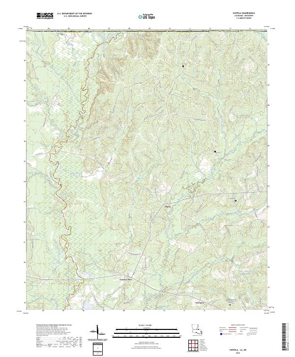
2024 Map of Chipola
USGS Topo · Published 2024About this map
The Amite River and its major tributaries, the West Fork Amite River and East Fork Amite River, carve a dense network of drainages across the boundary of East Feliciana and St. Helena Parishes. Small rural settlements like Chipola and Darlington serve as focal points for a landscape defined by timber and agriculture. In the southern portion of the map, the Black Creek African Methodist Episcopal Church Cem near Coleman Town provides a significant touchstone for local family history and genealogy. The terrain is a complex system of creek bottoms including Turkey Creek, Beaver Creek, and Joiner Creek, all feeding into the larger river system. A maze of parish roads and named lanes, such as Loyd Collins Rd and Aunt Margie's Rd, connect isolated homesteads and cemeteries like Hurst Cem and Wales Cem, reflecting a long-established pattern of dispersed rural living.
Find a feature on this map
72 named features on this map. Tap any name to fly to it.
Don’t see what you’re looking for? This feature index may not catch every label — zoom into the map to look around manually.
Map Details
Editions of this 2024 Chipola Map
This is the sole edition of this map. No revisions or reprints were ever made.
Other maps of this area

1941 · Woodland
USGS Topo · 1:31,680

1941 · Gilead
USGS Topo · 1:31,680

1941 · Chipola
USGS Topo · 1:31,680

1942 · Liverpool
USGS Topo · 1:31,680

1942 · Gilead
USGS Topo · 1:31,680

1945 · Chipola
USGS Topo · 1:31,680

1949 · Bluff Creek
USGS Topo · 1:31,680

1950 · Greensburg
USGS Topo · 1:31,680

1953 · Natchez
USGS Topo · 1:250,000

1954 · Baton Rouge
USGS Topo · 1:250,000