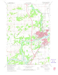
1972 Map of Chippewa Falls
USGS Topo · Published 1975About this map
Chippewa Falls sits at the confluence of the Chippewa River and Duncan Creek, serving as a central hub of industry and civic life in the early 1970s. The city's grid is dense with institutional landmarks, including the Courthouse, St Joseph Hospital, and several parochial schools like Notre Dame School and Holy Ghost School. Beyond the urban core, the landscape transitions into the smaller settlements of Irvine and Hallie, the latter marked by its proximity to Lake Hallie and the Old Badger Mills.
Find a feature on this map
68 named features on this map. Tap any name to fly to it.
Don’t see what you’re looking for? This feature index may not catch every label — zoom into the map to look around manually.
Map Details
Editions of this 1972 Chippewa Falls Map
2 editions found
Other maps of this area

1934 · Elk Mound
USGS Topo · 1:62,500

1934 · Chippewa Falls
USGS Topo · 1:62,500

1936 · Chippewa Falls
USGS Topo · 1:62,500

1936 · Elk Mound
USGS Topo · 1:62,500

1949 · Bloomer
USGS Topo · 1:62,500

1949 · New Auburn
USGS Topo · 1:62,500

1951 · Bloomer
USGS Topo · 1:62,500

1951 · New Auburn
USGS Topo · 1:62,500

1953 · Eau Claire
USGS Topo · 1:250,000

1953 · Rice Lake
USGS Topo · 1:250,000